Snow returned to Oregon’s mountains this week, and forecasters say some of that cold air may spill far enough north to bring accumulations into parts of Southwest Washington — including Longview and Kelso — as early as Wednesday night. The update comes from the National Weather Service office in Portland, which outlined several possible scenarios as conditions shift rapidly across the region. The full report was originally detailed by Oregon Public Broadcasting.
The Weather Service has issued a winter weather advisory for the Cascades, Cascade foothills and the Coast Range. Meteorologist David Bishop said the mountains should see steady accumulation through mid‑week, with one to two feet possible in higher elevations. Even so, he cautioned that the late‑season snowfall will not erase Oregon’s unusually dry winter or the record-low snowpack documented earlier this month, as reported in a related OPB analysis.
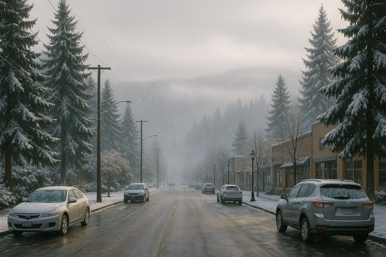
For Southwest Washington, the forecast remains uncertain. Bishop said the Weather Service is watching three main possibilities: no lowland snow at all; snow reaching Longview, Kelso and the Portland–Vancouver corridor; or snowfall favoring the southern Willamette Valley instead. Confidence is growing that some valley locations will see several inches, but pinpointing the exact band remains difficult with the current model spread.
The Weather Service also noted an ongoing threat of sneaker waves along the Oregon coast through Tuesday. Residents planning coastal travel or mountain recreation are encouraged by forecasters to check updated advisories, which may shift quickly as colder air settles in.
For now, local impacts in Cowlitz County hinge on how far north the incoming cold layer sets up. Any significant snow would be the first real lowland accumulation of the season for Longview and Kelso, after an otherwise warm and dry winter.
Why this matters
Lowland snow in Cowlitz County can create rapid travel disruptions on major corridors, including Interstate 5, Washington State Route 432 and State Route 4. With temperatures expected to hover near freezing, even modest accumulations could affect morning commutes, local deliveries and emergency response times. Residents and businesses may face short-notice operational adjustments if snow bands shift north.
The National Weather Service advises monitoring real-time conditions closely over the next 48 hours, especially for anyone traveling between Southwest Washington and the Mount Hood region, where heavy mountain snowfall is already underway.
Sources
Oregon Public Broadcasting: Snow is finally falling in Oregon’s mountains and could hit the lowlands
Oregon Public Broadcasting: Oregon’s record-low snowpack is not likely to recover, scientists say