
A fresh round of cold air is settling into the Lower Columbia region, and the National Weather Service (NWS) has again issued a Cold Weather Advisory affecting parts of southwest Washington and northwest Oregon. For Cowlitz County residents, the key takeaway is simple: overnight lows and wind chills are expected to be cold enough to raise real health and safety risks, especially for people without reliable heat, people sleeping outside, and anyone spending extended time outdoors.
Regional coverage has emphasized that temperatures in spots west of the Cascades could fall to around 20°F and that Friday night (Jan. 23) is expected to be among the coldest periods of this cold snap. (For Cowlitz County, that includes the Lower Columbia and Cowlitz River valleys.)
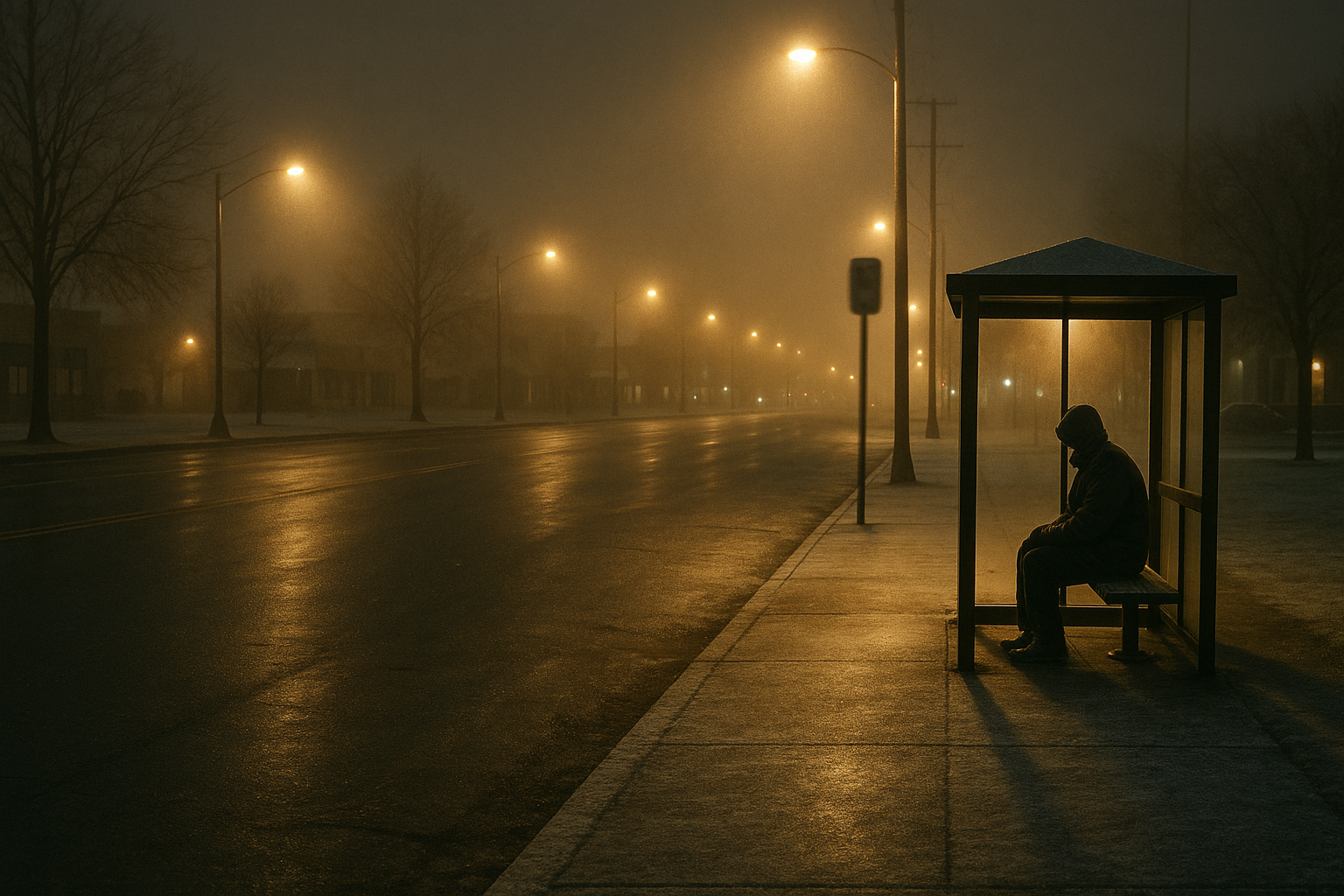
While much of the loudest weather messaging often centers on Portland, this is also a Cowlitz County story: cold-weather hazards don’t respect county lines, and the consequences disproportionately hit people with the least protection from the elements.
What the advisory means locally
A Cold Weather Advisory is issued when conditions are cold enough—often due to a combination of temperatures and wind—to increase the risk of hypothermia and frostbite. In this event, forecasters have highlighted very cold wind chills as the primary concern in the broader region.
OPB reported that the NWS advisory coverage stretches from southwest Washington down the Willamette Valley, with temperatures potentially dropping as low as 20°F in some areas west of the Cascades, including a corridor that explicitly includes Longview. In the same reporting, an NWS meteorologist described Friday as the coldest night of the period.
Who is most at risk
- Unhoused neighbors and people living in vehicles, tents, or makeshift shelters
- Seniors and people with disabilities, especially those who are isolated
- Infants and small children
- People with respiratory or heart conditions (especially when cold air and air stagnation coincide)
- Outdoor workers and anyone commuting early/late
- Households without stable heat or those relying on unsafe heating methods
Safety basics (and what not to do)
Meteorologists quoted by OPB have stressed the most important prevention steps: dress warmly, cover exposed skin, check on older family members and neighbors, and keep pets safe.
They also emphasized a common, deadly risk: carbon monoxide poisoning. Do not run charcoal grills indoors, and do not run generators in enclosed spaces (including garages). If you use portable heaters, follow manufacturer safety guidance and keep them away from flammable materials.
Community impact: cold weather is a public safety issue
Cold snaps are often treated like minor inconveniences—something you “power through” with an extra layer. But in practice, extreme cold turns into a systems test: housing insecurity, unaffordable utilities, and thin social safety nets become immediately visible.
In a county where many people already balance rising costs with stagnant wages, the simplest cold-weather advice—“turn up the heat”—can be unrealistic. That’s why, at a community level, this weather should be treated as a public safety and public health event, not just a forecast.
What to do tonight and this weekend
- Check on neighbors, especially seniors and anyone you haven’t seen in a while.
- Bring pets inside or provide warm, dry shelter and unfrozen water.
- Prepare your car: warm layers, blanket, charger, and water if you’re driving early or late.
- Protect pipes where possible; know where your shutoff is.
- Know the warning signs of hypothermia (confusion, shivering that stops, drowsiness) and frostbite (numbness, pale/waxy skin). Call 911 in emergencies.
Sources
-
- NWS coverage and regional reporting (OPB): https://www.opb.org/article/2026/01/23/oregon-southwest-washington-cold-snap/
- Earlier advisory context and safety guidance (OPB): https://www.opb.org/article/2026/01/21/cold-weather-advisory-southwest-washington-oregon/
Note: Columbia Countercurrent attempted to review the KOIN story linked in the tip, but the page did not load reliably at publication time. The reporting above relies on independently accessible regional reporting and NWS-linked alert details.

Leave a Comment