
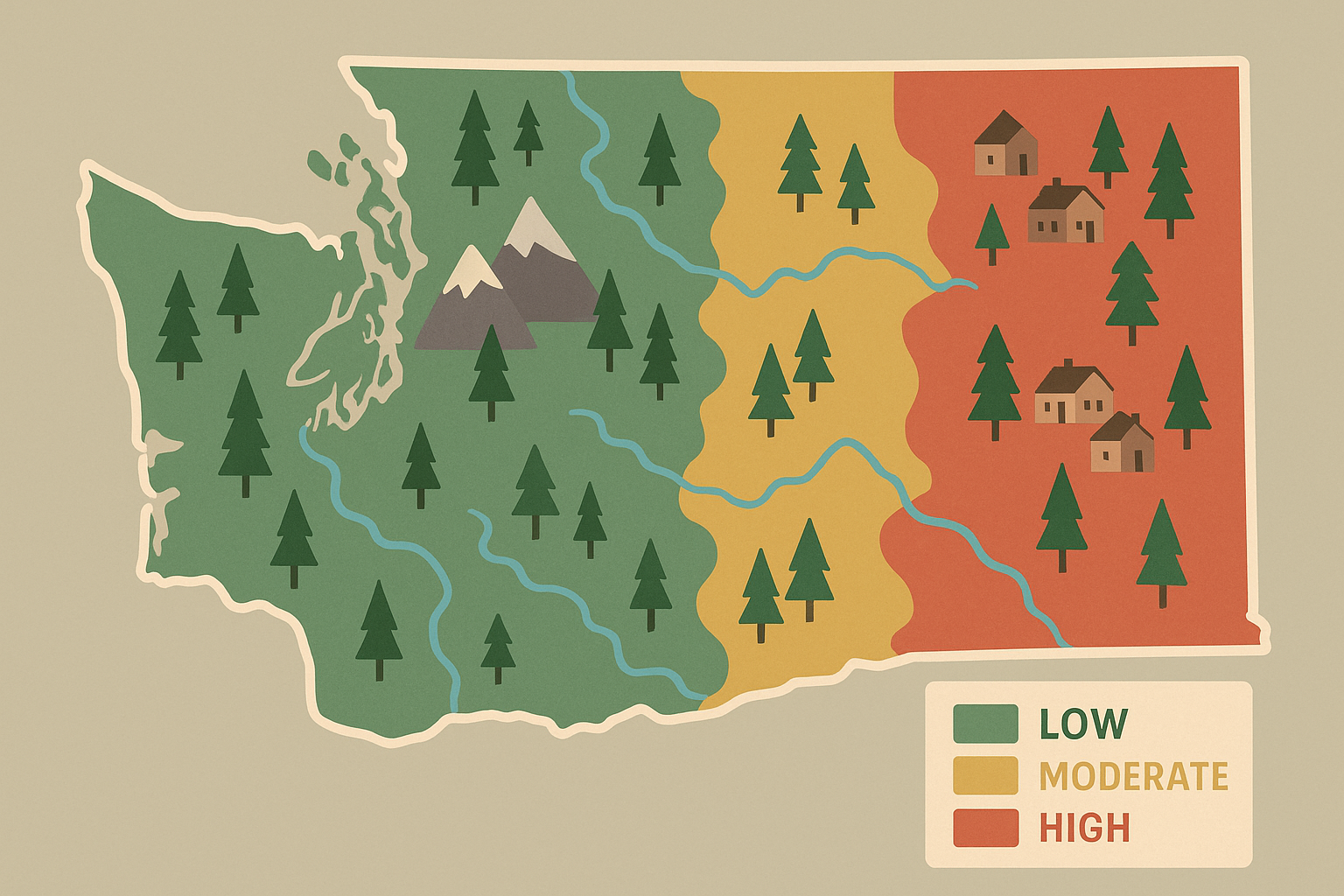
Washington’s Department of Natural Resources is developing a new set of statewide wildfire risk and hazard maps, and agency officials say public input will play a defining role in how those maps take shape. The effort stems from a 2024 directive from state lawmakers requiring DNR to create a system that can guide building codes, land‑use decisions, and long‑term wildfire planning.
According to reporting by Oregon Public Broadcasting, DNR staff have been holding listening sessions in multiple counties as they refine the structure of the mapping project. During a recent meeting in Goldendale, DNR wildland fire meteorologist Matt Dehr told attendees that technical modeling alone is not enough to capture the diverse conditions communities face. He emphasized that local knowledge is essential for determining whether proposed neighborhood boundaries or risk categories make sense on the ground.
Brigit Hill, DNR’s GIS data manager, explained that the work focuses on neighborhood‑level patterns rather than parcel‑by‑parcel analysis. According to OPB’s reporting, Hill said that earlier mapping efforts in other states relied heavily on pixel‑based models that were difficult for residents to interpret. Washington’s model aims to avoid similar pitfalls by incorporating localized insights earlier in the process.
The project includes two major map types. Risk maps will identify the potential for wildfire to damage homes, infrastructure, or other community assets. Hazard maps will outline the likelihood of wildfire occurring in a given area under current conditions. According to OPB’s reporting, draft versions are being built using a high‑powered U.S. Forest Service model that simulates thousands of potential fire seasons based on weather patterns and recent fire history.
Project manager Angie Lane told OPB that the maps are intended to help communities understand how homes, fuels, and landscape features interact with wildfire risk. She said that when that information is combined with hazard projections, it becomes a tool for setting priorities around forest thinning, prescribed burns, and building‑code updates. DNR officials also stated that the maps are not expected to influence insurance rates, noting that most insurers rely on their own proprietary systems.
For Southwest Washington communities—including Cowlitz County, where wildfire danger has posed increasing concerns in recent summers—the new maps may help local governments align mitigation work with emerging risk patterns. Neighborhood‑level analysis could be particularly relevant in areas where dense forest meets expanding residential development.
DNR is accepting public comments through the end of April, and the agency expects to release draft maps by July 1. According to OPB’s reporting, the department plans to make map revisions on an ongoing basis as new data, climate conditions, and local feedback become available.
Sources
Oregon Public Broadcasting: Washington state is building wildfire risk and hazard maps. Mapmakers need your help

Leave a Comment